
[cols]
[col class=”3/4″]
Survey Mapping by Efficient Drone
UAS Pacific provides high-quality, spatially accurate aerial survey and photographic services to the engineering, mining and environmental sectors. We offer aerial survey and mapping service nationwide, utilising premium UAV technology.
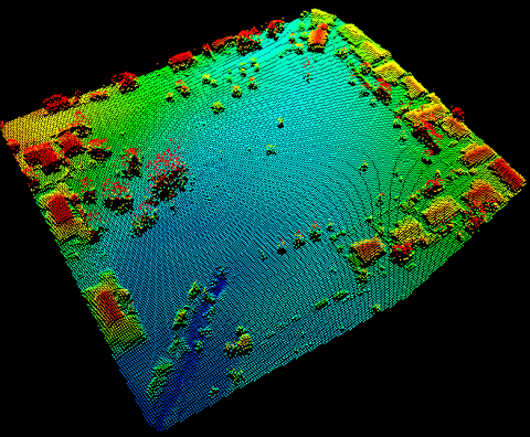
Finding a solution that best fits your business need, we supply either fixed wing or rotary aerial vehicles fitted with data capture equipment. When utilising GPS data, the high-resolution data captured by the UAV can be used to produce highly-accurate topographical maps, accurate surface models, point clouds and volumetric analysis.
Using a UAV allows for safe, flexible, and cost-effective survey work. Full turnkey management of the service by UAS Pacific will ensure ongoing effective survey services for your organisation.
How does Ortho-Photo Mosiacs work?
The digital mapping software takes all the aerial photos and combines them. Auto-corrections are made to help with distortions, and the resulting ‘ortho-mosiac’ (combined) image looks as if it had been taken by a satellite. As the image is geo-referenced, it can be displayed by any standard geographic information system (GIS) such as ESRI ArcGIS or Google Earth.
Benefits of Unmanned Aerial Surveying
[accordion]
[item title=”Saves Time”]
No need for ground survey, which can take days or even weeks.
[/item]
[item title=”Accurate”]
Collect survey data that is down to 1cm ground resolution.
[/item]
[item title=”Efficient”]
Turn weather-dependant manned aircraft work into unmanned aerial work that can operate in light rain or wind.
[/item]
[item title=”Safe”]
No need to access dangerous working areas, like mines or quarries. All UAVs are operated by CASA certified operators.
[/item]
[/accordion]
[spacer]
Contact UAS Pacific on (07) 3855 3590 for a no-obligation consultation about Survey Mapping by Drone
[/col]
[col class=”1/4 last”]
[/col]
[/cols]